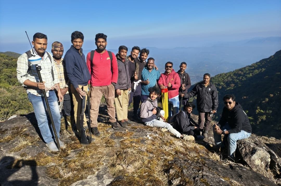
The District Digital Survey Special Team has successfully completed the demarcation of the Kozhikode–Wayanad district boundary in the difficult terrain of the Banasura hills.
The boundary work was carried out in the forest areas covering Kanjirangad and Thondernad villages. The region falls under the Mananthavady Range of the North Wayanad Forest Division and is known for its steep hills and rocky, challenging landscape.
The survey area can only be reached after more than four hours of trekking from the nearest point accessible by vehicle. Since commuting daily was impractical, the team set up a temporary camp inside the forest and stayed there to complete the work.
The mission was carried out under the guidance of Survey Deputy Director R. Babu, Assistant Director K. Balakrishnan, and Survey Superintendent Mohammed Shareef. The 11-member team was led by Head Surveyor Prabin C. Pavithran.
As per the directions of North Wayanad DFO R. Satheesh Kumar and Mananthavady Range Officer Rose Mary Jose, 10 forest department personnel from the Makkiyad Forest Station assisted the survey team.
The coordinated efforts of the survey and forest teams ensured the successful completion of the boundary demarcation in the rugged terrain.